Front:
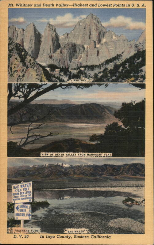
Mt. Whitney and Death Valley-Highest and Lowest Points in U. S. A.
BAD WATER
279.6 FEET
BELOW SEA LEVEL
LOWEST POINT IN THE
WESTERN HEMISPHERE
SHOSHONE 57
BAKER 93
FURNACE CREEK 17
MT. WHITNEY
VIEW OF DEATH VALLEY FROM MAHOGANY FLAT
FRASHERS FOTO
D. V. 30
66
BAD WATER'
In Inyo County, Eastern California
Back:
"THE HIGH AND LOW IN ELEVATION, TEM-
PERATURE AND SCENERY-Top Mt. Whitney,
the roof of our 48 states, towering 14,496 feet
into the clouds, and the crest of the Sierra
Range.
Mahogany Flat, elevation 8400 ft. a wooded
vantage point from which one may view
Death Valley to the east, and the Sierra
Range to the west.
Bad Water, 279.6 feet below sea level, is
the basement of our 48 states, as well as the
lowest point in the Western Hemisphere.
Inyo County, California, therefore rightfully
boasts the roof and basement of our 48 states,
separated by approximately 80 miles in direct
line, and but a few hours distance by rail
and motor car.
OB-H1516
"C.T. ART-COLORTONE''-DISTRIBUTED BY FRASHER'S, INC., POMONA, CALIF.
Frashers
FOTOS
