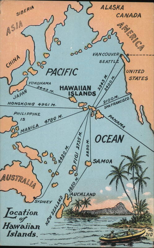
Front:
ASIA
SIBERIA
ALASKA
CHINA
00000
PACIFIC
JAPAN
YOKOHAMA
3443 M.
HAWAIIAN
ISLANDS
HONGKONG 4961 M.
PHILIPPINE
IS
00
MANILA
4780 M.
VANCOUVER
SEATTLE
2343 M.
2400 M.
2100M.
AMERICA
SAN FRANCISCO.
OCEAN
SAMOA
NEW ZEALAND
3850 M.
4420 M.
80 FIGI 2735 M.
2250 M.
AUSTRALIA
SYDNEY
Location
of
Hawaiian
Islands.
AUCKLAND
210
Back:
GARTE POSTALE
POSTAL GARD
Private Mailing Card
CORRESPONDENCE SPACE
The Hawaiian Islands lie in the
North Pacific Ocean, between 18° 54'
and 22° 15' North Latitude, and
154° 50' and 160° 30' West Longi-
tude. In 1899 the Islands were an-
nexed to the United States by Joint
Resolution of the American Congress,
I and in 1900 Hawaii became a terri-
tory of the Union. The important
Islands are eight in number, Niihau,
Kauai, Oahu, Molaki, Maui, Lauai,
Kahoolawe and Hawaii and contain
about 6700 square miles and support
a population of 200,000 souls.
Published by the Island Curio Co., Honolulu, Hawaiian Islands.
TWO CENTS


