Front:
10
12
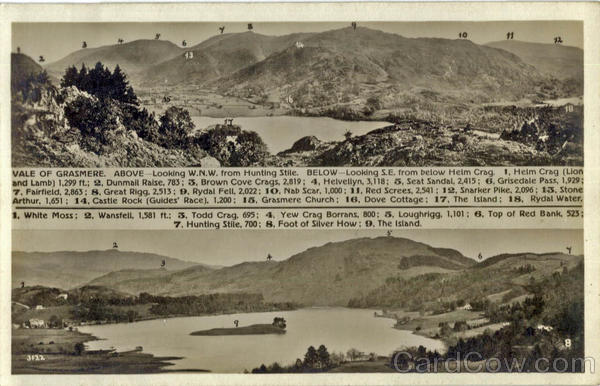
VALE OF GRASMERE. ABOVE-Looking W.N.W. from Hunting Stile. BELOW-Looking S.E. from below Helm Crag. 1, Helm Crag (Lion
and Lamb] 1,299 ft.; 2, Dunmail Raise, 783; 3, Brown Cove Crags, 2,819; 4, Helvellyn, 3,118; 5, Seat Sandal, 2,415; 6, Grisedale Pass, 1,929;
7. Fairfield, 2,863; 8, Great Rigg, 2,513; 9, Rydal Fell, 2,022; 10, Nab Scar, 1,000; 11, Red Screes, 2,541; 12, Snarker Pike, 2,096; 13, Stone
Arthur, 1,651; 14, Castle Rock (Guides' Race), 1,200; 15, Grasmere Church; 16, Dove Cottage; 17, The Island; 18, Rydal Water.
1. White Moss; 2, Wansfell, 1,581 ft.; 3, Todd Crag, 695; 4, Yew Crag Borrans, 800; 5, Loughrigg, 1,101; 6, Top of Red Bank, 523:
7. Hunting Stile, 700; 8, Foot of Silver How; 9, The Island.
3122
9
Back:
Actual photograph by G. P. ABRAHAM, Ltd. Keswick (Copyright).
Post Card


